


The Northern Brownfields Assistance Center at WVU strives to inspire communities to plan brownfield redevelopment projects. Brownfield sites are located all over the state and our goal is to provide assistance with these sites. This project viewer allows the user to search, filter, or zoom to a location to see all projects associated with the Brownfields Assistance Center at WVU from 2006 to present. Click on specific projects to view more information such as the project name, community, county, historic use, project year and much more!
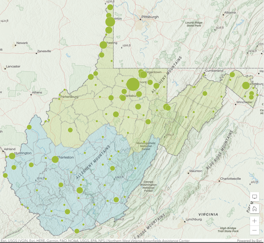
https://wvu.maps.arcgis.com/apps/webappviewer/index.html?id=4042f583abec4b76bdeca5d303844e16
Follow this link to explore the ArcGIS project inventory map.

Nicole Dias Chosen for Generation WV Fellowship
Nicole Dias, a project associate with WVU BAD Buildings and the WV Brownfields Assistance Center (BAC) at WVU, was recently selected as part of the prestigious Generation West Virginia (GWV) Fellowship Class of 2023.
Read More
Five Brownfields Projects in West Virginia Awarded Mini-Grants, Technical Assistance
Five brownfields projects in West Virginia have received grant funding from the Claude Worthington Benedum Foundation. The former Brooke Glass project in Wellsburg and the former TS&T Pottery site ...
Read MoreNBAC Director Testifies on BUILD Act Before U.S. Senate Committee
On March 2, Patrick Kirby, director of the Northern West Virginia Brownfields Assistance Center at West Virginia University, provided testimony on the BUILD Act before the U.S. Senate Committee ...
Read More